Old maps can open portals to the past. Notations, icons and omissions give clues to solving history mysteries – or create more questions.
Walt Reed’s family reaches back generations at Clark Lake. Over the years, he has helped shed light on the community’s history. This map is an example.
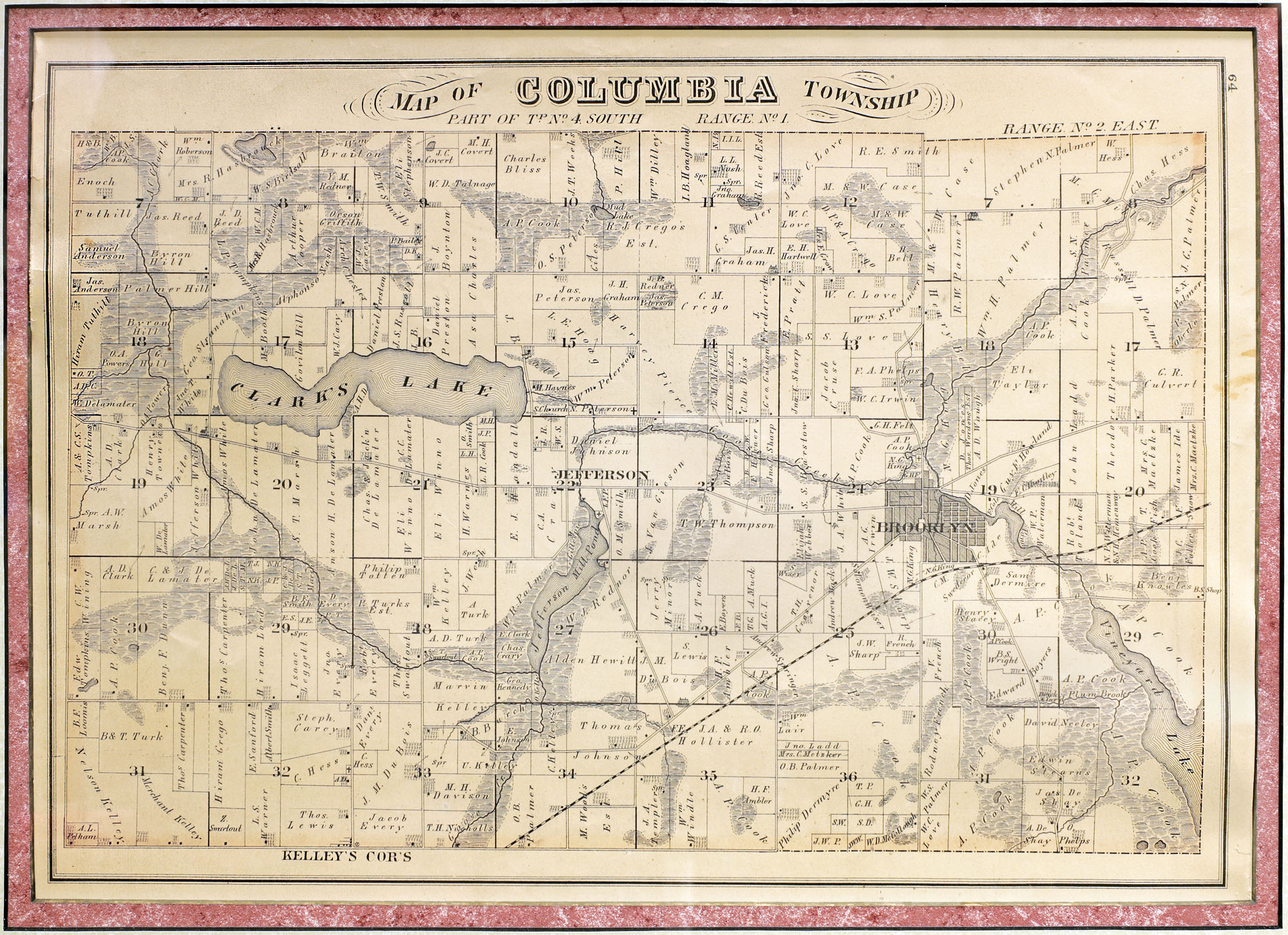
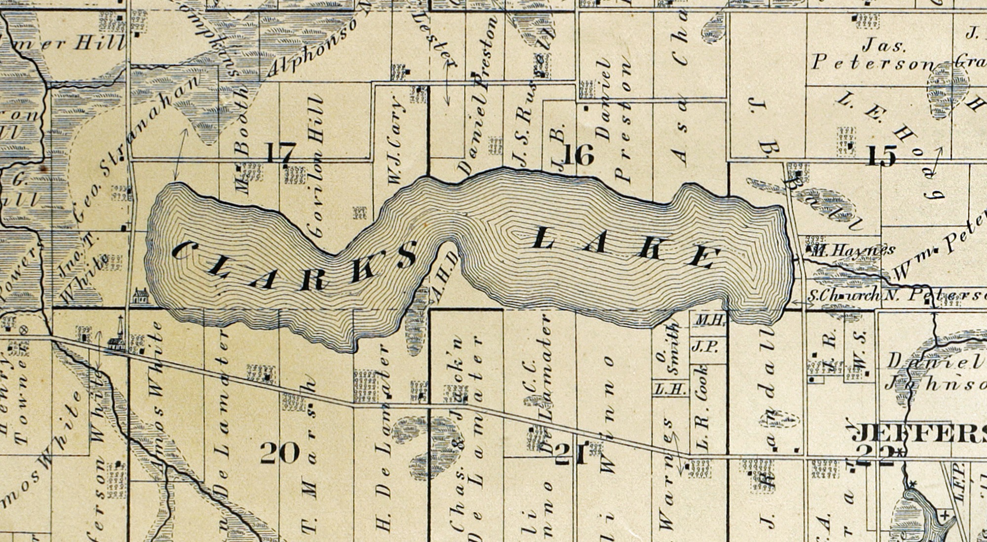
Close up of Clark’s Lake
This map will join other maps and Clark Lake artifacts at the Community Center.
Walt believes this Columbia Township plat map dates back to about 1873. How he arrived at that conclusion adds context to Clark Lake’s history. Here’s what he found.
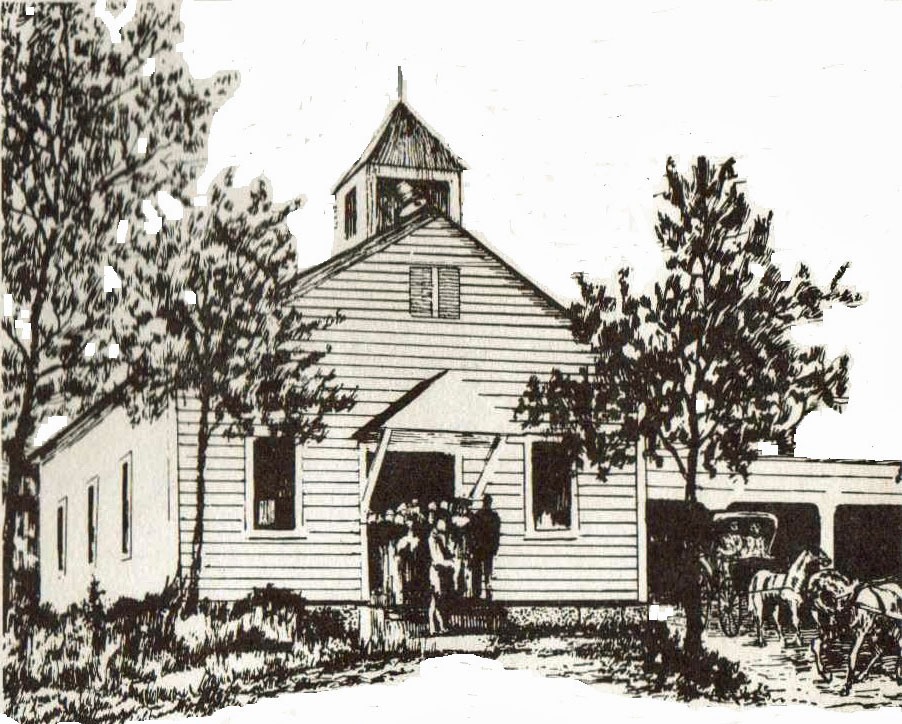
The northwest corner of Jefferson and Hyde Roads includes a church symbol. The Clarklake Baptist Church was founded in 1868, but not built at that location until 1872.
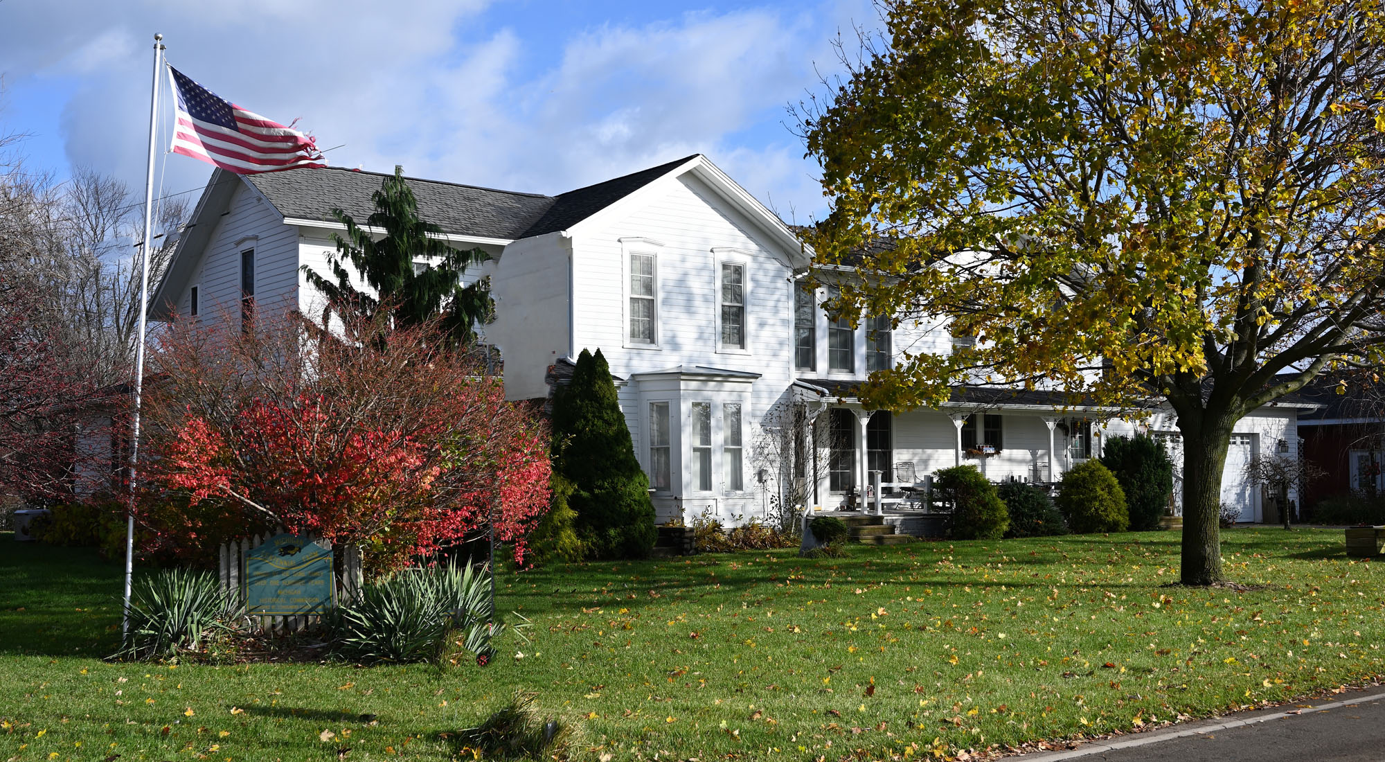
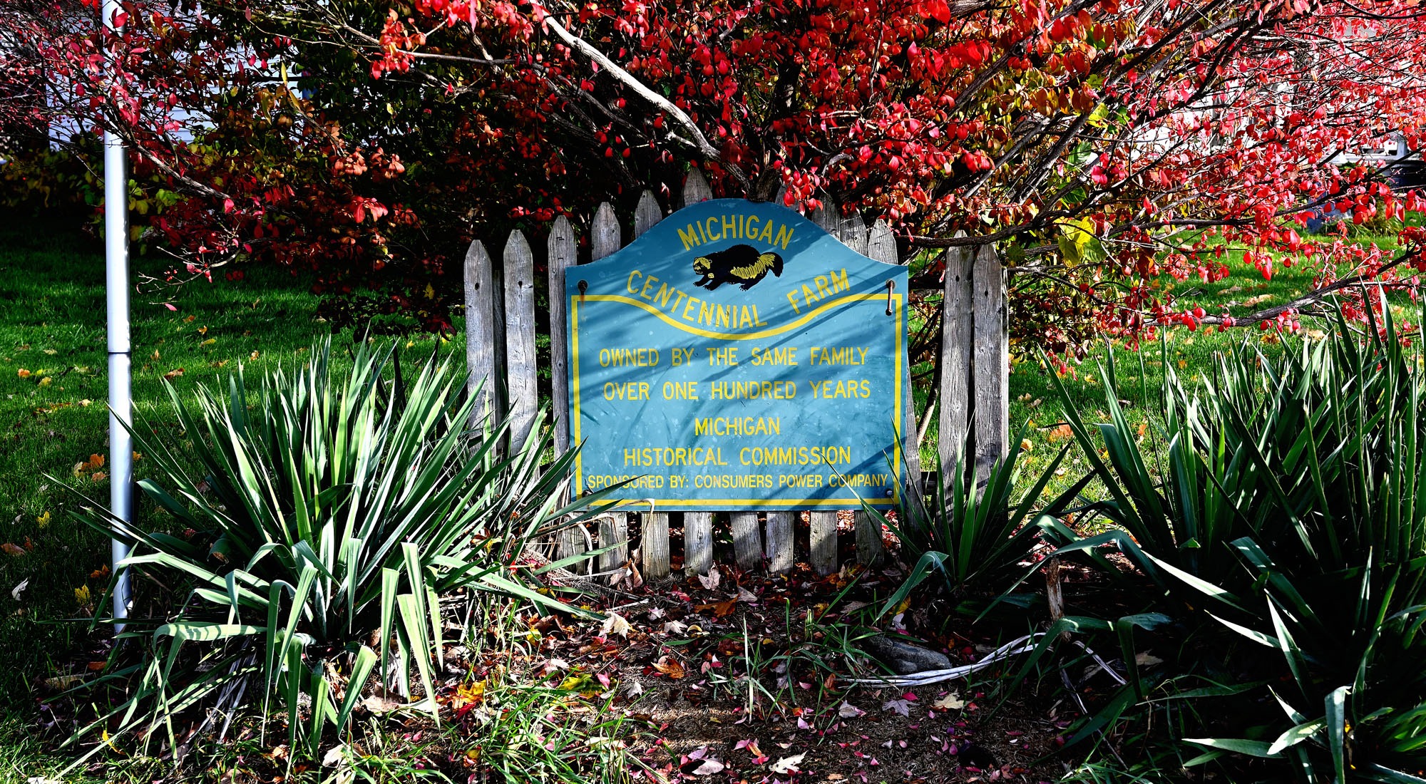
The northeast corner of the Hyde/Reed Roads intersection does not show the home built by J.D. Reed in 1874. There could have been a delay in putting the home on the plat map, so the date of the map could be later than 1874, but not by much more than a couple years. (Today, Walt and Joy Reed continue to live in the Reed Farm House which bears an historical marker).
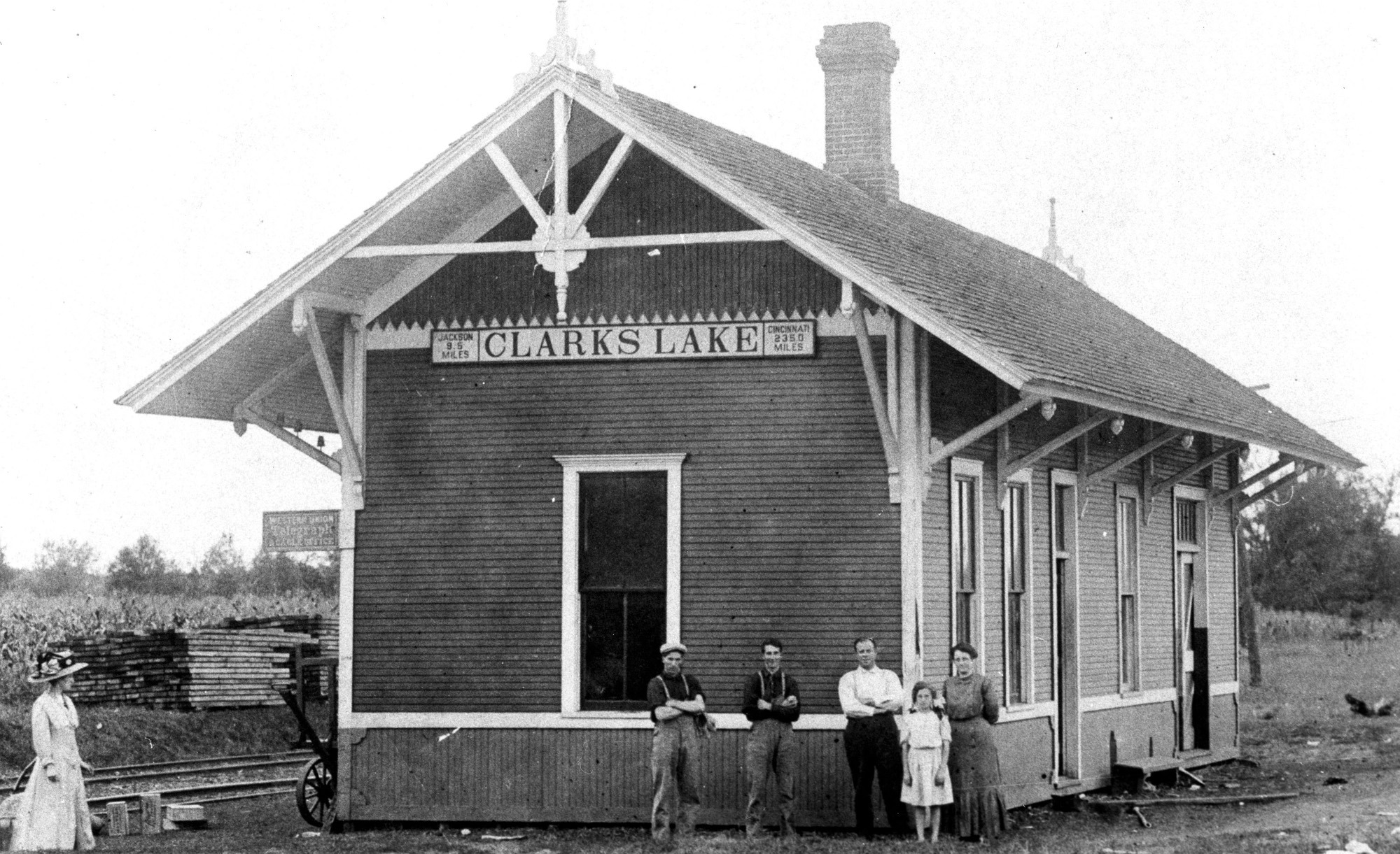
The map does not show the Cincinnati Northern Railroad tracks that would later parallel Hyde Road. The railroad first arrived at Clark Lake in 1896.
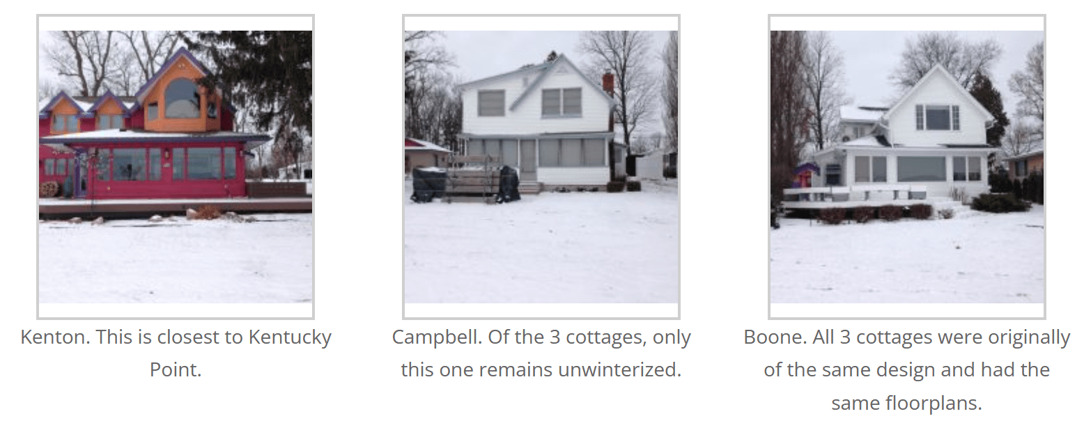
Kentucky Point is not well defined on the map. No road can be seen behind it on the map. The Graziani’s didn’t arrive at Clark Lake until the railroad brought them here in 1896. The cottage on Kentucky Point was built during the winter of 1898-9. The three cottages in the Kentucky Park Cove were built a short time earlier. Benjamin Graziani bought them as well as the land on which he built the main cottage known as the Kentucky Homestead. He named the three existing cottages after Kentucky counties – Kenton, Campbell & Boone.
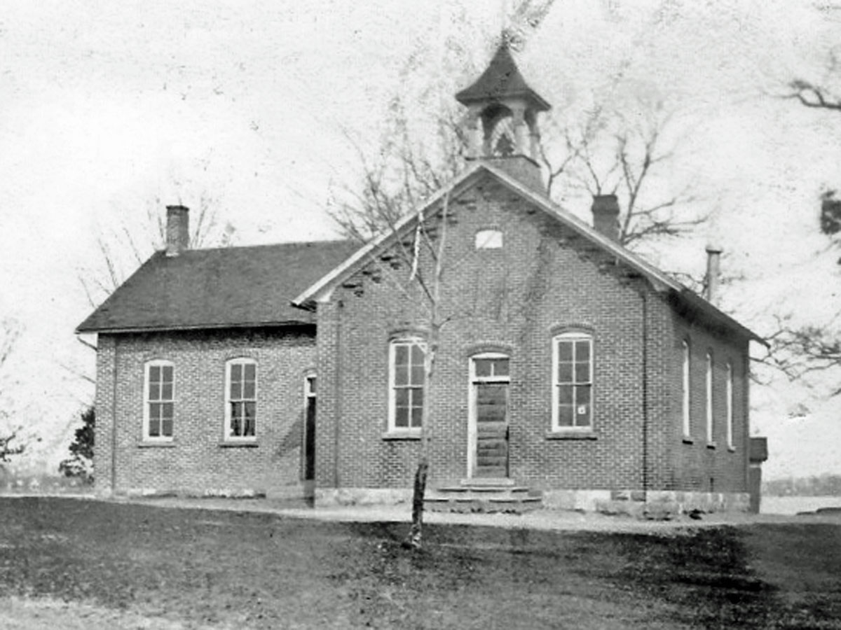
The map depicts only one building on the lake – the school house where the Columbia Township Park is now located.
Walt comments “my dad said the lake was how we watered the cows and fished.”
Other notes about this map.
- No buildings are shown in Jefferson Village, but waterwheel icons identify two mills, a grist mill and lumber mill. The cemetery is also depicted.
- A cross identifies another cemetery north of Brooklyn on the road that became M50. The cemetery was moved when the road was widened.
- Columbia High School sports complex is located where the one room Hollister school was located.