by Bill Leutz
In previous articles we have looked at the histories of some of the first settlers at Clark’s Lake. I thought it might be interesting to look at what was happening in the bigger picture of Northeastern America; the events that delayed the development of Michigan, but eventually led to the influx of settlers during the decade of the 1830’s.
Following the Revolutionary War in 1783, The Treaty of Paris defined the lands that would be included in the United States. Part of this was an area then known as the Northwest Territory; defined as consisting of the lands west of Pennsylvania, north of the Ohio River, and east of the Mississippi. As such it encompassed the present day states of Ohio, Indiana, Illinois, Michigan, Wisconsin, and portions of Northern Minnesota. A year later, The Northwest Ordinance of 1784, set out the rules for developing and governing this area.
In 1814, The Treaty of Ghent, which ended of the War of 1812, settled all border conflict between the United States and Great Britain. From then on, we were not only at peace with our neighbors to the north, but good friends. The shape of the northern border through the Great Lakes area, which was established by The Treaty of Paris, was confirmed and redefined at Ghent.
Due to the barriers of the Appalachian Mountains and Niagara Falls, westward settlement during the period from 1814 to 1830 was mostly confined to overland routes leading to the Ohio River Valley.
In 1815, U.S. Surveyor General Edward Tiffin commissioned a survey of southeastern Michigan. It was directed at plans of providing land as reward for veterans of the War of 1812. This was the first survey of Michigan lands, and established the all-important geographic base map for all future development. This week (October 20, 2015) an article celebrating the 200th anniversary of this survey appeared in the Brooklyn Exponent. However, after surveying portions of the land, including Jackson County where drainage was a problem, Tiffin’s surveyors provided an unfavorable report. Tiffin then reported to President James Madison that “… Michigan apparently consisted of swamps, lakes and sandy soil not worth the cost of surveying …. and in his opinion not one acre in one hundred, and perhaps a thousand, could be cultivated.” This report discouraged Michigan settlement and, as a result, encouraging more settlers to take the Ohio River. Because of this, Ohio established statehood as early as 1803 while Indiana statehood in 1816 and Illinois statehood in 1818 followed, 20 years before Michigan’s.
The Erie Canal, across northern New York State, was completed in 1825 and the Welland Canal around Niagara Falls, in 1827. These canals provided easy travel between the east coast and the Great Lakes. The Erie Canal, for instance cut the transit time from New York City to Lake Erie to 6 days, and reduced shipping costs from $100 per ton to less than $10 per ton. Soon ships were being built, specifically designed for lake travel, connecting eastern lake ports with the distant ports in all the Great Lakes except Lake Superior. There, the original 1798 lock around St. Marys’ Rapids (Sault St Marie), had been destroyed during the War of 1812 and was not fully repaired until 1895.
Early steam ships like the shipyards at Black Rock in the upper Niagara River, at Erie Pennsylvania, and at Sackets Harbor at the foot of Lake Ontario They were all on the lakes by 1827. Topsail Schooners like the Illinois were still far more common, and moved the majority of settlers and cargos throughout the lower lakes.
In 1812, the conclusion of Black Hawks War, with the Sac and Fox Nation along the Mississippi, opened up northern and central Illinois to settlement. The 1834 maiden voyage of the Illinois was one of the early efforts to move large numbers of settlers to these new Illinois lands. It left Sackets Harbor, taking about a month to traverse all four of the southern Great Lakes, and arrived at the foot of Lake Michigan where Chicago would one day grow. This water route eliminated the two to three month overland trek across the states of Pennsylvania, Ohio and Indiana. Ships like the Illinois were soon leaving settlers all along their route through the Great Lakes. The early natural harbors, like those at Cleveland, Sandusky, and Toledo in Ohio – Detroit, and Saginaw in Michigan – Green Bay, Wisconsin, and Chicago became the landing points for these settlers. Our present-day lake ports quickly grew at these locations.
The General Survey Act of 1824 prompted a new survey to explore routes for roads and canals to develop the country. One of the acts of this survey was to chart the old Sauk Trail, converting it to the Detroit-Chicago Pike. It was during this survey that the reports of surveyors like Robert Clark, Jr., who named Clark’s Lake, finally began to correct the mistakes of Tiffin’s 1815 report. With the clarification of the quality of land in Michigan, and the advent of an improved transportation mechanism, Michigan quickly became attractive for settlement. In the next 10-15 years settlement boomed. The year 1829 saw the founding of the city of Jackson; the villages of Brooklyn and Napoleon followed in 1832; and Manchester in 1833. This all lead to the creation of Michigan as the 22nd state on January 26, 1837.
Included in this rapid growth, were those first settlers mentioned in my earlier articles; people like George Stranahan and Anson De Lameter. They followed that lure of new opportunity that has always been the basis of the pioneering spirit, and brought settlement to Clark’s Lake in 1834.
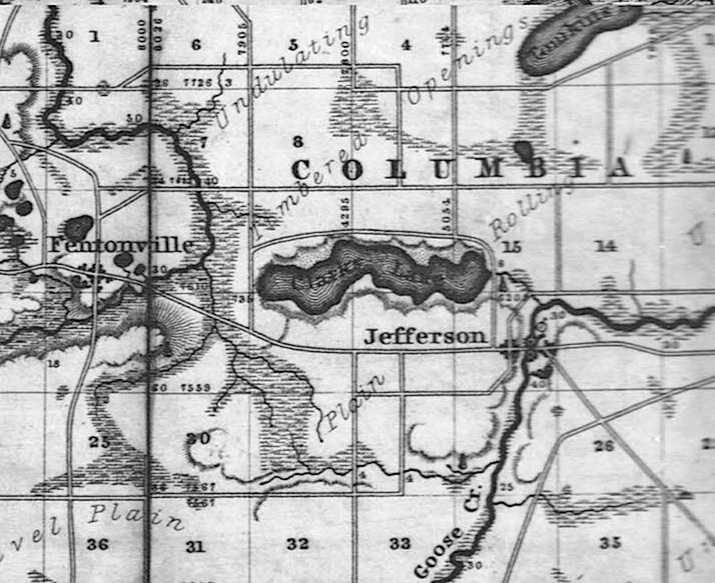
This map dates to the early 1800s