by Bill Leutz
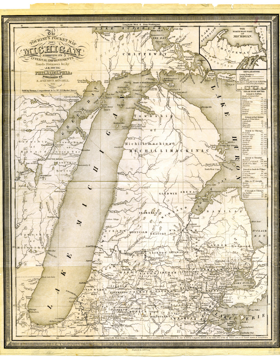
Last week I had the good fortune to be included in a small group, including Ann Swain and Dean & Betsy Frazen, who were invited to spend some time in the home of friends on Beaver Island, in northern Lake Michigan. While there I had the opportunity to observe the oldest map of Michigan I have yet found. In 1839, S. Augustus Mitchell of Philadelphia published this “Tourist’s Pocket Map of Michigan.” This was only two years after Michigan achieved statehood, and much of the northern portions of the state were still relatively unknown. This map is very similar to the 1830 map found on page 18 of Ted Ligibel’s book, Clark Lake: Images of a Michigan Tradition ( Clark Lake Historical Preservation Committee, 1991).
MSU Libraries
A Google search of the Internet found additional information on this matter. Much of the detail of this 1839 map was drawn from an earlier, 1831 map, by John Farmer, which was published in NYC by J.H. Colton & Co. At that time, only the southern half of the state had been broken up into counties. Nearly everything north of Mt. Pleasant was still in Indian hands and was included in one massive township called Michillimacinac. Little was known of the Upper Peninsula beyond St. Ignace.
Due to the age of the map, I would conclude that most of the local information was based on Robert Clark, Jr.’s original 1824 survey. Looking closely at the map, I found some historic points that I thought might be of interest to my Clark Lake neighbors.
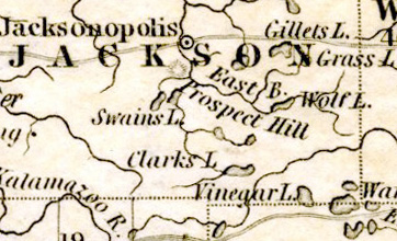
Specific points of interest in regard to Jackson County include the fact that the city of Jackson was then known as Jacksonopolis. There is also an indication of an Indian Village shown on Rice Creek (Kalamazoo River tributary) north of present day Albion. Although without a name, this village was also shown in W. B. Hinsdale’s Archeological History of Michigan (University of Michigan Press, 1931, Ann Arbor).
A few of the well-known area lakes were also included in this map, some with different names or locations. Clarks Lake, Wamplers Lake and Gillets Lake are named and shown fairly correctly. However, Clarks Lake and Swains Lake are shown as draining into the Grand River. Swains Lake, actually near Concord, is shown directly north of Clarks Lake. Actually, Clarks Lake drains into the Raisin, and Swains Lake drains into the Kalamazoo. Vinyard Lake was shown as Vinegar Lake, and Devils Lake is shown with the alternate Indian name of Michemanetue.
All of this shows how uncertain the topographic details were to those earliest settlers of the lake in 1834 and 1835. Even the question of the drainage divide between Lake Erie and Lake Michigan was apparently still uncertain.
MSU Libraries